The valley alternative over the Pyrenees, open all winter
Saint Jean Pied de Port → Santiago de Compostela
Loading map…
The Valcarlos Route is shown in yellow; the purple line is the Camino Francés it belongs to — zoom out to see the whole way to Santiago.
Distance744 km
Walking time—
Elevation profile · 11,906 m ascent
Two routes leave Saint-Jean-Pied-de-Port for Roncesvalles: the high Napoleon Route over the open mountain and the Valcarlos Route through the valley of the Nive. Valcarlos is longer on the road but lower and sheltered, which is why it is the only permitted crossing from 1 November to 31 March, when the Napoleon Route is closed for safety.
Walk the Valcarlos Route with Camino.Today
Plan your stages on the map, see the elevation profile and the weather for every hour of your walk, find albergues along the way and talk to pilgrims on the same route — free, offline-ready, in English, Spanish and Russian.
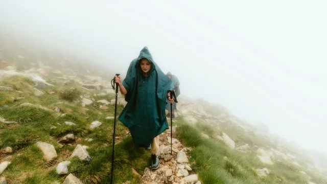
There are two routes from Saint Jean Pied de Port to Roncesvalles: the scenic but exposed Napoleon Route (left column) over the mountains and the safer Valcarlos Route (right column) through the valley.
The Napoleon Route is usually chosen in good weather but is closed from November 1 to March 31, when the Valcarlos Route becomes the only option.
Difficulty
Moderate. A long steady climb, mostly on quiet road and forest track.
Places along the way
Valcarlos
Km 12
A Basque village in the valley of Charlemagne, the traditional winter halt between Saint-Jean and Roncesvalles.
Puerto de Ibañeta
Km 21
The pass at 1,057 metres where the route rejoins the Napoleon Route, with a chapel and the monument to Roland.
Stages
Every pilgrim walks the Valcarlos Route at a different pace, so this page does not prescribe daily stages. In the Camino.Today app you pick any two towns on the route and get the stage between them — distance, walking time, elevation profile and the weather for each hour of the walk. Plan the whole Camino stage by stage before you leave, or decide each morning how far you go today; the plan is yours to change at any time.
Towns along the way
Distances from Saint Jean Pied de Port. Every town and village within a kilometre of the path, as shown in the app.
0.2 kmSaint Jean Pied de Port
8 kmArnéguy
14.4 kmGañecoleta
21.6 kmPuerto de Ibañeta
29.1 kmEspinal
34 kmBizkarreta
40 kmAlto de Erro
43.2 kmZubiri
62.2 kmPamplona
66.8 kmCizur Menor
72.8 kmZariquiegui
78.3 kmUterga
90 kmMañeru
97.5 kmLorca
102.1 kmVillatuerta
105.8 kmEstella
112.3 kmAzqueta
125.3 kmLos Arcos
132.6 kmSansol
142.8 kmViana
151.8 kmLogroño
159.9 kmAlto de la Grajera
163.3 kmNavarrete
169.7 kmVentosa
179.3 kmNájera
184.8 kmAzofra
193.3 kmCiriñuela
199.6 kmSanto Domingo de la Calzada
205.9 kmGrañón
209.6 kmRedecilla del Camino
216.2 kmVillamayor del Río
221.2 kmBelorado
225.8 kmTosantos
232.6 kmVillafranca Montes de Oca
236.1 kmAlto de la Pedraja
244.3 kmSan Juan de Ortega
248.1 kmAgés
268.8 kmBurgos
278.9 kmTardajos
288.6 kmHornillos del Camino
294.2 kmArroyo San Bol
299.1 kmHontanas
304.6 kmSan Antón - The Ruins
307.9 kmCastrojeriz
311.6 kmAlto de Mostelares
316.9 kmErmita de San Nicolás
327.1 kmBoadilla del Camino
332.8 kmFrómista
336.4 kmPoblación de Campos
339.6 kmRevenga de Campos
346.1 kmVillalcázar de Sirga
351.6 kmCarrión de los Condes
368.4 kmCalzadilla de la Cueza
374.6 kmLedigos
377.6 kmTerradillos de los Templarios
380.8 kmMoratinos
390.8 kmSahagún
395.6 kmCalzada de Coto
400.9 kmBercianos del Real Camino
408.4 kmEl Burgo Ranero
421.1 kmReliegos
426.8 kmMansilla de las Mulas
431.6 kmVillamoros de Mansilla
437.6 kmArcahueja
448.6 kmTrobajo del Camino
451.6 kmLa Virgen del Camino
461.1 kmChozas de Abajo
465.4 kmVillar de Mazarife
474.9 kmVillavante
479.2 kmPuente de Órbigo
492.4 kmSan Justo de la Vega
495.8 kmAstorga
509.1 kmEl Ganso
515.6 kmRabanal del Camino
520.6 kmFoncebadón
528 kmAlto de Cerezales
531.4 kmEl Acebo
534.9 kmRiego de Ambrós
538.6 kmMolinaseca
542.8 kmCampo
546.4 kmPonferrada
561 kmCacabelos
569.5 kmVillafranca del Bierzo
574 kmPereje
578.5 kmTrabadelo
582.2 kmLa Portela de Valcarce
591.1 kmLa Faba
598.5 kmLinares
606.6 kmFonfría
618.5 kmSan Cristovo do Real
630.9 kmSivil
661.5 kmToxibo
692.9 kmFurelos
697.5 kmRaído
732.5 kmSan Paio
739 kmSan Marcos
744 kmSantiago de Compostela
Common questions
How long is the Valcarlos Route?
744 km from Saint Jean Pied de Port to Santiago de Compostela, with about 11,906 m of climbing along the way.
How difficult is the Valcarlos Route?
Moderate. A long steady climb, mostly on quiet road and forest track.
When is the best time to walk the Valcarlos Route?
Late April to early June and mid-September to mid-October are the most comfortable windows: mild weather, long days and everything open. July and August are hot inland and busy; from November to March many private albergues close.
From the blog
Short, honest posts about walking to Santiago — gear, money, routes and the things nobody warns you about.