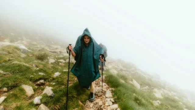
Camino Francés

The classic Way of St James from the Pyrenees to Santiago

Saint Jean Pied de PortSantiago de Compostela

Loading map…
Distance780 km
Walking time30-35 days
Elevation profile · 11,713 m ascent
0 m500 m1000 m1500 m0 km250 km500 km750 km

The Camino Francés is the route most people picture when they hear the word Camino: 780 kilometres from the French Basque town of Saint-Jean-Pied-de-Port over the Pyrenees, across the plains of Castile and through the green hills of Galicia to the cathedral of Santiago de Compostela. It carries more pilgrims than every other route combined, and its infrastructure — albergues every few kilometres, waymarks on every corner, bars that open before dawn — is why so many first-time pilgrims choose it.

The route in four parts

The first days cross Navarre: the climb over the Pyrenees to Roncesvalles, the descent to Pamplona, the Alto del Perdón with its iron pilgrims, and the vineyards of La Rioja around Logroño. It is the most physically demanding start of any Camino, and the point where most new pilgrims discover what a 25-kilometre day feels like.

From Burgos to León the route crosses the Meseta, the high plateau of Castile. Long straight tracks, wheat to the horizon, villages built of adobe and stone. Some pilgrims skip it by bus; those who walk it usually call it the part of the Camino that changed them most.

After León the mountains return. The route climbs to the Cruz de Ferro, the highest point of the whole Camino at 1,500 metres, drops to Ponferrada and the vineyards of El Bierzo, then climbs again to O Cebreiro and the green, wet, granite world of Galicia.

The final 100 kilometres from Sarria are the busiest stretch of any Camino, because that is the minimum distance for the Compostela certificate. Eucalyptus forests, small farms, and a growing crowd of pilgrims carry you to Monte do Gozo and down into Santiago.

Walk the Camino Francés with Camino.Today


Plan your stages on the map, see the elevation profile and the weather for every hour of your walk, find albergues along the way and talk to pilgrims on the same route — free, offline-ready, in English, Spanish and Russian.

How long does it take?

Most pilgrims walk the full Camino Francés in 30 to 35 days, averaging 22 to 26 kilometres a day with one or two rest days in Pamplona, Burgos or León. Walking from Sarria takes five days; from León about twelve; from Burgos around twenty.

When to walk

May, June, September and early October are the classic months: long days, mild temperatures, albergues open everywhere. July and August are hot on the Meseta and crowded from Sarria. Winter is quiet and beautiful but the Napoleon Route over the Pyrenees is closed from November to March, and many albergues shut between December and February.

Getting to the start

Saint-Jean-Pied-de-Port is reached by train from Bayonne, which connects to Paris, Bordeaux and Biarritz airport. Pamplona, Logroño, Burgos, León and Sarria all have train or bus links from Madrid for those starting later on the route.

Difficulty

Moderate. Well-marked and well-served, with two mountain stages at the start and around O Cebreiro.

Places along the way

Saint-Jean-Pied-de-Port

Start, French Basque Country

A walled town on the Nive with a cobbled main street, the Porte Saint-Jacques through which pilgrims from all over Europe have entered since the Middle Ages, and the pilgrim office where most people collect their first credential stamp. The citadel above the town gives a view of the mountains you will cross tomorrow.

The Pyrenees and Roncesvalles

Km 0–25, Navarre

The Napoleon Route climbs to 1,430 metres at the Col de Lepoeder, above the tree line, with vultures overhead and, in clear weather, both France and Spain below. The descent ends at the abbey of Roncesvalles, where Charlemagne's rearguard was destroyed in 778 and where a 13th-century Gothic church still holds a pilgrim mass every evening.

Pamplona

Km 68, Navarre

The first city on the route and the capital of Navarre: a compact old town of stone streets, the Gothic cathedral, the citadel park and the Calle Estafeta, where the bulls run every July. Pilgrims usually arrive on the fourth day, in time for the pintxo bars.

Alto del Perdón

Km 81, above Pamplona

A ridge of wind turbines and the iron sculpture of a line of pilgrims, one of the most photographed points of the Camino. The inscription reads 'where the way of the wind crosses that of the stars'. The stony descent on the other side is short but famous for twisted ankles.

Puente la Reina

Km 92, Navarre

The six-arched Romanesque bridge over the Arga, built in the 11th century for pilgrims, gives the town its name. This is where the Aragonese route from the Somport pass joins the French one; the single main street has church after church.

Logroño and La Rioja

Km 160

The wine capital of Spain. Calle Laurel is a street of tapas bars, each known for one dish, and the days after Logroño run through vineyards to Nájera and the cathedral town of Santo Domingo de la Calzada, where a rooster and hen live inside the cathedral.

Burgos cathedral

Km 285, Castile

The finest Gothic cathedral in Spain, begun in 1221, with the tomb of El Cid under the crossing and a spire that pilgrims first see from hours away across the plain. Burgos is also where the Meseta begins.

The Meseta

Km 285–480

Two hundred kilometres of high plateau between Burgos and León: wheat, sky, adobe villages, Roman roads and the canal of Castile. Some pilgrims take a bus around it; those who walk it describe it as the part of the Camino where the noise in their head finally stopped.

León

Km 480

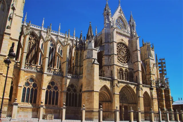
A Roman legionary camp turned medieval capital. The cathedral has more stained glass than stone, San Isidoro's Royal Pantheon is the 'Sistine Chapel of the Romanesque', and Gaudí built the Casa Botines on the main square. Most pilgrims take a rest day here.

Cruz de Ferro

Km 550, Montes de León

An iron cross on a tall oak pole at 1,500 metres, the highest point of the Camino Francés, surrounded by a mound of stones. Pilgrims bring a stone from home and leave it here, with whatever it represents. The descent to Molinaseca and Ponferrada is long and steep.

O Cebreiro

Km 670, border of Galicia

A hamlet of round thatched pallozas at 1,300 metres, reached by the last big climb of the route. Its pre-Romanesque church keeps the chalice of a medieval Eucharistic miracle, and the priest of O Cebreiro, Elías Valiña, invented the yellow arrow that marks every Camino today.

Sarria and the last 100 km

Km 630 from the start, 115 km to Santiago

Because the Compostela requires at least 100 kilometres on foot, Sarria is where most pilgrims begin. The final week passes Portomarín, rebuilt above a reservoir, the octopus town of Melide, eucalyptus forests and Monte do Gozo, the hill from which the cathedral towers first appear.

Santiago de Compostela

Finish

The Praza do Obradoiro, the baroque facade of the cathedral, the Pórtico da Gloria inside, the tomb of the Apostle under the altar and, on feast days, the swinging botafumeiro. The pilgrim office issues the Compostela; the old town's granite arcades and markets are for the days after.

Stages

Every pilgrim walks the Camino Francés at a different pace, so this page does not prescribe daily stages. In the Camino.Today app you pick any two towns on the route and get the stage between them — distance, walking time, elevation profile and the weather for each hour of the walk. Plan the whole Camino stage by stage before you leave, or decide each morning how far you go today; the plan is yours to change at any time.

Where to sleep on the Camino Francés

965 places to sleep in 199 towns along this route, 455 of them pilgrim albergues — with prices, beds, photos, contacts and the map.

All places on this route →

Variants and links

Towns along the way

Distances from Saint Jean Pied de Port. Every town and village within a kilometre of the path, as shown in the app.

  1. 0 kmSaint Jean Pied de Port
  2. 4.8 kmHonto
  3. 15.1 kmCollado de Bentartea
  4. 19 kmCollado de Lepoeder
  5. 22.4 kmRoncesvalles
  6. 28.8 kmEspinal
  7. 33.8 kmBizkarreta
  8. 39.7 kmAlto de Erro
  9. 43 kmZubiri
  10. 62 kmPamplona
  11. 66.6 kmCizur Menor
  12. 72.6 kmZariquiegui
  13. 78.1 kmUterga
  14. 89.7 kmMañeru
  15. 97.2 kmLorca
  16. 101.8 kmVillatuerta
  17. 105.5 kmEstella
  18. 112.1 kmAzqueta
  19. 125.1 kmLos Arcos
  20. 132.3 kmSansol
  21. 142.5 kmViana
  22. 151.6 kmLogroño
  23. 159.7 kmAlto de la Grajera
  24. 163.1 kmNavarrete
  25. 169.4 kmVentosa
  26. 179.1 kmNájera
  27. 184.6 kmAzofra
  28. 193.1 kmCiriñuela
  29. 199.3 kmSanto Domingo de la Calzada
  30. 205.7 kmGrañón
  31. 209.3 kmRedecilla del Camino
  32. 216 kmVillamayor del Río
  33. 220.9 kmBelorado
  34. 225.6 kmTosantos
  35. 232.3 kmVillafranca Montes de Oca
  36. 235.8 kmAlto de la Pedraja
  37. 244.1 kmSan Juan de Ortega
  38. 247.8 kmAgés
  39. 268.5 kmBurgos
  40. 278.7 kmTardajos
  41. 288.4 kmHornillos del Camino
  42. 294 kmArroyo San Bol
  43. 298.8 kmHontanas
  44. 304.3 kmSan Antón - The Ruins
  45. 307.7 kmCastrojeriz
  46. 311.3 kmAlto de Mostelares
  47. 316.6 kmErmita de San Nicolás
  48. 326.8 kmBoadilla del Camino
  49. 332.5 kmFrómista
  50. 336.1 kmPoblación de Campos
  51. 339.4 kmRevenga de Campos
  52. 345.9 kmVillalcázar de Sirga
  53. 351.3 kmCarrión de los Condes
  54. 368.2 kmCalzadilla de la Cueza
  55. 374.3 kmLedigos
  56. 377.4 kmTerradillos de los Templarios
  57. 380.5 kmMoratinos
  58. 390.5 kmSahagún
  59. 395.4 kmCalzada de Coto
  60. 400.6 kmBercianos del Real Camino
  61. 408.2 kmEl Burgo Ranero
  62. 420.8 kmReliegos
  63. 426.5 kmMansilla de las Mulas
  64. 431.3 kmVillamoros de Mansilla
  65. 437.4 kmArcahueja
  66. 448.3 kmTrobajo del Camino
  67. 451.4 kmLa Virgen del Camino
  68. 460.8 kmChozas de Abajo
  69. 465.2 kmVillar de Mazarife
  70. 474.7 kmVillavante
  71. 479 kmPuente de Órbigo
  72. 492.1 kmSan Justo de la Vega
  73. 495.5 kmAstorga
  74. 508.8 kmEl Ganso
  75. 515.4 kmRabanal del Camino
  76. 520.4 kmFoncebadón
  77. 531.1 kmEl Acebo
  78. 534.6 kmRiego de Ambrós
  79. 538.4 kmMolinaseca
  80. 542.5 kmCampo
  81. 546.1 kmPonferrada
  82. 560.7 kmCacabelos
  83. 569.3 kmVillafranca del Bierzo
  84. 573.8 kmPereje
  85. 578.3 kmTrabadelo
  86. 582 kmLa Portela de Valcarce
  87. 590.9 kmLa Faba
  88. 598.3 kmLinares
  89. 606.4 kmFonfría
  90. 618.3 kmSan Cristovo do Real
  91. 630.6 kmSivil
  92. 661.2 kmToxibo
  93. 692.6 kmFurelos
  94. 697.2 kmRaído
  95. 732.3 kmSan Paio
  96. 738.8 kmSan Marcos
  97. 743.7 kmSantiago de Compostela

Common questions

How long is the Camino Francés?

780 km from Saint Jean Pied de Port to Santiago de Compostela, with about 11,713 m of climbing along the way.

How many days do you need to walk it?

Most pilgrims take 30-35 days, which works out at roughly 20 to 25 kilometres a day. You can walk it in fewer days or split it across several trips — the route is the same.

How difficult is the Camino Francés?

Moderate. Well-marked and well-served, with two mountain stages at the start and around O Cebreiro.
Where do you sleep on the Camino Francés?

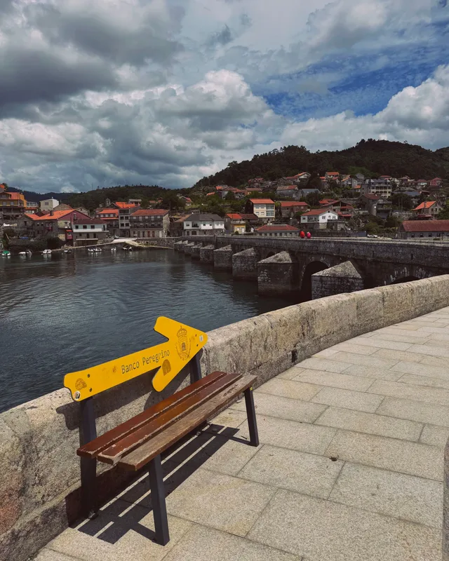
There are 965 places to sleep along the route in 199 towns and villages, 455 of them pilgrim albergues. Each one has its prices, beds, photos and contacts on this site.

When is the best time to walk the Camino Francés?

Late April to early June and mid-September to mid-October are the most comfortable windows: mild weather, long days and everything open. July and August are hot inland and busy; from November to March many private albergues close.

What is the Camino Francés like?

The first days cross Navarre: the climb over the Pyrenees to Roncesvalles, the descent to Pamplona, the Alto del Perdón with its iron pilgrims, and the vineyards of La Rioja around Logroño. It is the most physically demanding start of any Camino, and the point where most new pilgrims discover what a 25-kilometre day feels like.

From the blog

Short, honest posts about walking to Santiago — gear, money, routes and the things nobody warns you about.

All posts →