From the junction the route continues along the Camino Francés to Santiago.
Distance1000 km
Walking time40-50 days
Elevation profile · 11,645 m ascent
The Vía de la Plata follows the Roman road that linked Mérida with Astorga, and it is the longest and loneliest of the great Caminos: around a thousand kilometres from Seville through Extremadura and Castile before the choice at Granja de Moreruela between continuing to Astorga and the Camino Francés, or turning west onto the Camino Sanabrés. Long stages, few pilgrims and Roman ruins define it.
What the route is like
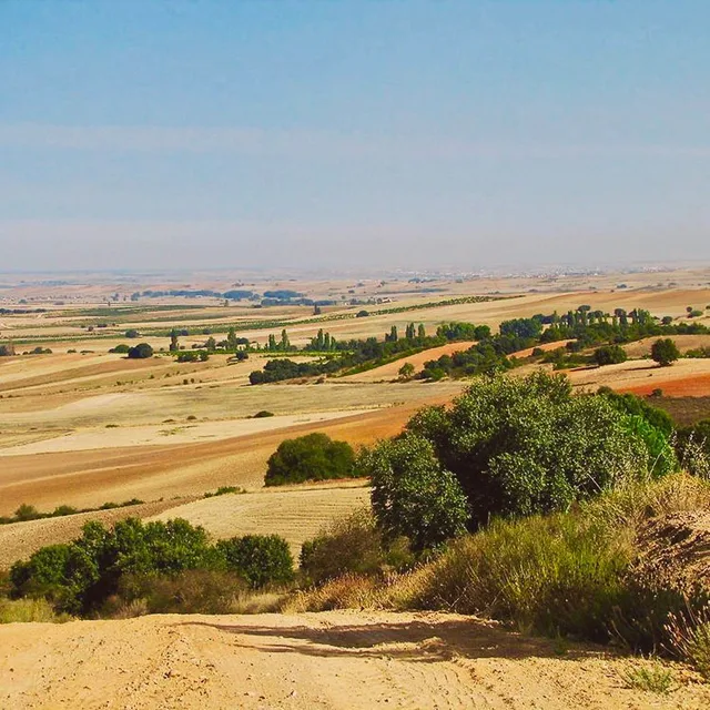
From Seville the route crosses the Andalusian countryside to Zafra and Mérida, whose Roman theatre and bridge are the best in Spain. Cáceres, a UNESCO old town, and the arch of Cáparra follow. Salamanca, with its two cathedrals and golden university, is the emotional halfway point; from there the tracks of the Castilian plain lead to Zamora and Granja de Moreruela.
Pilgrims who stay on the Vía de la Plata continue north to Benavente and Astorga, where they join the Camino Francés for its final 260 kilometres through the Bierzo and Galicia. Those who take the Sanabrés turn west through Puebla de Sanabria and Ourense, a shorter and quieter finish.
Walk the Vía de la Plata with Camino.Today
Plan your stages on the map, see the elevation profile and the weather for every hour of your walk, find albergues along the way and talk to pilgrims on the same route — free, offline-ready, in English, Spanish and Russian.
Forty to fifty days to Santiago via Astorga; around forty via the Sanabrés. Stages of 30 kilometres and more are common because of the distances between villages.
When to walk
March to May and September to October. Summer in Extremadura regularly exceeds 40 °C and is genuinely dangerous on the exposed stages; winter is feasible but cold on the meseta.
Getting to the start
Seville has an international airport and high-speed trains from Madrid. The route begins at the cathedral.
Difficulty
Hard by length and heat rather than terrain: long, exposed stages and limited services.
Places along the way
Seville
Start
The largest cathedral in Spain, the Giralda minaret turned bell tower, the Alcázar palace and the Triana quarter across the river. The route leaves along the Guadalquivir past the Roman city of Itálica, birthplace of the emperors Trajan and Hadrian.
Monesterio and the dehesa
Km 100
Into Extremadura through the dehesa, the park-like landscape of holm oaks where the black Iberian pigs feed on acorns. Monesterio has a ham museum and a reputation for the best jamón on the route.
Zafra
Km 145
Called 'little Seville' for its two arcaded plazas; the castle of the Dukes of Feria is now a parador.
Mérida
Km 210
Augusta Emerita, capital of Roman Lusitania, with the best Roman remains in Spain: a theatre still used for a summer festival, an amphitheatre, the Temple of Diana, aqueducts and the 60-arch bridge over the Guadiana that pilgrims cross to leave.
Cáceres
Km 270
A walled old town of Renaissance palaces, towers and storks' nests, a World Heritage site where almost nothing has changed since the 16th century.
The arch of Cáparra
Km 385
A four-sided Roman arch standing alone in the fields — the only thing left of a town on the Roman road. The Camino passes directly under it.
Salamanca
Km 490
The golden sandstone city: the Plaza Mayor, the old and new cathedrals side by side, the university founded in 1218 and the Casa de las Conchas covered in carved scallop shells. Roughly halfway to Santiago.
Zamora
Km 560
The city of Romanesque churches — more than twenty — above the Duero, with a cathedral whose dome is covered in stone scales.
Granja de Moreruela
Km 600
The ruins of the first Cistercian monastery in Spain and the point of decision: north to Astorga and the Camino Francés, or west onto the Camino Sanabrés.
Astorga
Km 690
Where the Vía de la Plata joins the Camino Francés under Gaudí's Episcopal Palace. The remaining 260 kilometres cross the Montes de León and Galicia with the crowds of the French route.
Stages
Every pilgrim walks the Vía de la Plata at a different pace, so this page does not prescribe daily stages. In the Camino.Today app you pick any two towns on the route and get the stage between them — distance, walking time, elevation profile and the weather for each hour of the walk. Plan the whole Camino stage by stage before you leave, or decide each morning how far you go today; the plan is yours to change at any time.
Where to sleep on the Vía de la Plata
591 places to sleep in 147 towns along this route, 286 of them pilgrim albergues — with prices, beds, photos, contacts and the map.
Distances from Sevilla. Every town and village within a kilometre of the path, as shown in the app.
0 kmSevilla
9.4 kmSantiponce
22.1 kmGuillena
40.1 kmCastilblanco de los Arroyos
60.7 kmArroyo de los Zahurdones
66.9 kmCerro del Calvario
81.6 kmEl Real de la Jara
92.7 kmEl Culebrín
101.2 kmMonesterio
113.9 kmArroyo del Bodión
122.2 kmFuente de Cantos
128.2 kmCalzadilla de los Barros
132.8 kmArroyo Atarja
142.6 kmPuebla de Sancho Pérez
146.4 kmZafra
149.4 kmAlto de San Cristóbal
158.6 kmLa Almazara
165.5 kmVillafranca de los Barros
192.7 kmTorremejía
208.4 kmMérida
213.9 kmProserpina
221.6 kmEl Carrascalejo
243.2 kmAlcuéscar
251.1 kmCasas de Don Antonio
258 kmAldea del Cano
268.7 kmValdesalor
273.3 kmPuerto de las Camellas
280 kmCáceres
290.7 kmCasar de Cáceres
312.7 kmEmbalse de Alcántara
323.1 kmCañaveral
331.6 kmGrimaldo
351.3 kmGalisteo
356.7 kmAldehuela del Jerte
361.8 kmCarcaboso
374.4 kmVentaquemada
380.4 kmCáparra
399.2 kmAldeanueva del Camino
404.3 kmLas Cañadas
408.6 kmBaños de Montemayor
415.3 kmPuente de la Malena
420.8 kmLa Calzada de Béjar
429.6 kmValverde de Valdelacasa
432.9 kmValdelacasa
440.9 kmFuenterroble de Salvatierra
454.9 kmPico de la Dueña
461.8 kmCalzadilla del Mendigos
468.4 kmSan Pedro de Rozados
472.5 kmMorille
491.7 kmSalamanca
497.8 kmAldeaseca de la Armuña
503 kmCastellanos de Villiquera
507.1 kmCalzada de Valdunciel
514.1 kmHuelmos
527.5 kmEl Cubo de Tierra del Vino
540.5 kmVillanueva de Campeán
546.3 kmSan Marcial
558.8 kmZamora
565.4 kmRoales del Pan
577.4 kmMontamarta
589.3 kmFontanillas de Castro
593 kmRiego del Camino
599.5 kmGranja de Moreruela
608.7 kmSantovenia del Elsa
614.6 kmVillanueva del Agua
622.7 kmVillanueva del Azoagua
626.1 kmBenavente
633.9 kmVillabrázaro
642.3 kmMaire de Castroponce
648.2 kmÁlija del Infantado
656.4 kmQuintana del Marco
659.8 kmVillanueva de Jamuz
664 kmSta. Elena de Jamuz
668.5 kmLa Bañeza
674.1 kmPalacios de La Valduerna
688.7 kmCelada
692.5 kmAstorga
706.3 kmEl Ganso
712.9 kmRabanal del Camino
717.9 kmFoncebadón
728.6 kmEl Acebo
732.1 kmRiego de Ambrós
735.9 kmMolinaseca
740 kmCampo
743.6 kmPonferrada
758.2 kmCacabelos
766.8 kmVillafranca del Bierzo
771.3 kmPereje
775.8 kmTrabadelo
779.5 kmLa Portela de Valcarce
788.4 kmLa Faba
795.8 kmLinares
803.9 kmFonfría
815.8 kmSan Cristovo do Real
828.1 kmSivil
858.7 kmToxibo
890.1 kmFurelos
894.7 kmRaído
929.8 kmSan Paio
936.3 kmSan Marcos
941.2 kmSantiago de Compostela
Common questions
How long is the Vía de la Plata?
1000 km from Sevilla to Santiago de Compostela, with about 11,645 m of climbing along the way.
How many days do you need to walk it?
Most pilgrims take 40-50 days, which works out at roughly 20 to 25 kilometres a day. You can walk it in fewer days or split it across several trips — the route is the same.
How difficult is the Vía de la Plata?
Hard by length and heat rather than terrain: long, exposed stages and limited services.
Where do you sleep on the Vía de la Plata?
There are 591 places to sleep along the route in 147 towns and villages, 286 of them pilgrim albergues. Each one has its prices, beds, photos and contacts on this site.
When is the best time to walk the Vía de la Plata?
Late April to early June and mid-September to mid-October are the most comfortable windows: mild weather, long days and everything open. July and August are hot inland and busy; from November to March many private albergues close.
What is the Vía de la Plata like?
From Seville the route crosses the Andalusian countryside to Zafra and Mérida, whose Roman theatre and bridge are the best in Spain. Cáceres, a UNESCO old town, and the arch of Cáparra follow. Salamanca, with its two cathedrals and golden university, is the emotional halfway point; from there the tracks of the Castilian plain lead to Zamora and Granja de Moreruela.
From the blog
Short, honest posts about walking to Santiago — gear, money, routes and the things nobody warns you about.