The short route from Ferrol, the pilgrims' port of northern Europe
Ferrol → Santiago de Compostela
Loading map…
Distance120 km
Walking time5-7 days
Elevation profile · 2,193 m ascent
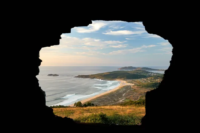
In the Middle Ages pilgrims from England, Ireland and Scandinavia sailed to the rías of Galicia and walked the last stretch to Santiago; the Camino Inglés is that walk. From Ferrol it is 120 kilometres, enough to earn the Compostela, through estuaries, eucalyptus woods and small Galician towns, and it can be walked in under a week.
What the route is like
The first stages follow the Ferrol and Betanzos estuaries through Neda and Pontedeume, whose medieval bridge once had 79 arches. Betanzos, with its old town on a hill between two rivers, is the halfway point. After Bruma the route crosses rolling farmland and forest to Sigüeiro and the final approach into Santiago from the north.
The alternative start at A Coruña is shorter than 100 kilometres, so it only earns the Compostela for pilgrims who can prove they walked a prior stretch in their home country; it joins the Ferrol route near Bruma.
Walk the Camino Inglés with Camino.Today
Plan your stages on the map, see the elevation profile and the weather for every hour of your walk, find albergues along the way and talk to pilgrims on the same route — free, offline-ready, in English, Spanish and Russian.
Five to seven days from Ferrol; four from A Coruña.
When to walk
Any month is possible. Galicia is mild but wet; late spring and September give the driest conditions. The short length makes it a good winter Camino.
Getting to the start
Ferrol and A Coruña are an hour apart by train, and A Coruña's airport has connections to Madrid, Barcelona and London. Santiago airport is a 90-minute bus ride from Ferrol.
Difficulty
Easy to moderate. Short stages with a few steady climbs.
Places along the way
Ferrol
Start
A naval port since the 18th century, with the Magdalena quarter laid out on a grid and the shipyards where the Spanish navy is still built. The route begins at the Curuxeiras quay, where English and Irish pilgrims once landed.
Pontedeume
Km 20
A medieval town under the tower of the Andrade lords; its bridge over the Eume, now 15 arches, once had 79. The climb out of town over Breamo is the hardest of the route.
Betanzos
Km 44
One of the seven ancient capitals of Galicia, on a hill between two rivers, with Gothic churches, glassed balconies and a famous potato omelette. Halfway to Santiago.
Hospital de Bruma
Km 68
A crossroads with a medieval pilgrim hospital, where the branch from A Coruña joins. The albergue here is the traditional overnight before the last two days.
Sigüeiro
Km 88
A bridge over the Tambre and the last village before Santiago's outskirts.
Stages
Every pilgrim walks the Camino Inglés at a different pace, so this page does not prescribe daily stages. In the Camino.Today app you pick any two towns on the route and get the stage between them — distance, walking time, elevation profile and the weather for each hour of the walk. Plan the whole Camino stage by stage before you leave, or decide each morning how far you go today; the plan is yours to change at any time.
Where to sleep on the Camino Inglés
93 places to sleep in 22 towns along this route, 42 of them pilgrim albergues — with prices, beds, photos, contacts and the map.
Distances from Ferrol. Every town and village within a kilometre of the path, as shown in the app.
0 kmFerrol
5.8 kmPolígono da Gándara
13.7 kmSanta María de Neda
24.9 kmCabanas
34.6 kmMiño
44.1 kmBetanzos
50.8 kmLa Iglesia
62.6 kmSanta Mariña de Beira
72.7 kmA Rúa
82.4 kmBaxoia
89.3 kmSigüeiro
93.2 kmAgualada
99.5 kmPolígono de Tambre
103.7 kmSantiago de Compostela
Common questions
How long is the Camino Inglés?
120 km from Ferrol to Santiago de Compostela, with about 2,193 m of climbing along the way.
How many days do you need to walk it?
Most pilgrims take 5-7 days, which works out at roughly 20 to 25 kilometres a day. You can walk it in fewer days or split it across several trips — the route is the same.
How difficult is the Camino Inglés?
Easy to moderate. Short stages with a few steady climbs.
Where do you sleep on the Camino Inglés?
There are 93 places to sleep along the route in 22 towns and villages, 42 of them pilgrim albergues. Each one has its prices, beds, photos and contacts on this site.
When is the best time to walk the Camino Inglés?
Late April to early June and mid-September to mid-October are the most comfortable windows: mild weather, long days and everything open. July and August are hot inland and busy; from November to March many private albergues close.
What is the Camino Inglés like?
The first stages follow the Ferrol and Betanzos estuaries through Neda and Pontedeume, whose medieval bridge once had 79 arches. Betanzos, with its old town on a hill between two rivers, is the halfway point. After Bruma the route crosses rolling farmland and forest to Sigüeiro and the final approach into Santiago from the north.
From the blog
Short, honest posts about walking to Santiago — gear, money, routes and the things nobody warns you about.