From the junction the route continues along the Camino Francés to Santiago.
Distance825 km
Walking time32-38 days
Elevation profile · 10,186 m ascent
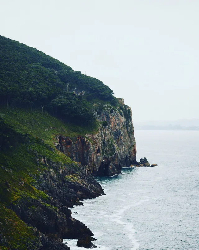
The Camino del Norte follows the Bay of Biscay from Irún, on the French border, through San Sebastián, Bilbao, Santander and Gijón before turning inland in Galicia to join the Camino Francés at Arzúa. It is longer, hillier and quieter than the Francés, trading the Meseta for cliffs, fishing villages and beaches you can swim from at the end of a stage.
What the route is like
The Basque stages are the hardest: constant climbs and descents between coves, with the reward of San Sebastián, Zarautz and Bilbao along the way. Cantabria flattens a little and adds Santillana del Mar and Comillas; Asturias brings Llanes, Ribadesella and the option to leave for the Camino Primitivo at Villaviciosa. In Galicia the route passes Ribadeo and Mondoñedo before the long, green approach to Arzúa, where it merges with the Camino Francés for the last two days into Santiago.
Albergues are less frequent than on the Francés, especially in Cantabria and Asturias, so stages are sometimes dictated by where you can sleep rather than by how far you want to walk. Booking ahead in July and August is sensible.
Walk the Camino del Norte with Camino.Today
Plan your stages on the map, see the elevation profile and the weather for every hour of your walk, find albergues along the way and talk to pilgrims on the same route — free, offline-ready, in English, Spanish and Russian.
Plan for 32 to 38 days for the whole route, more if you want rest days in the cities. Many pilgrims walk it in two or three sections over several years.
When to walk
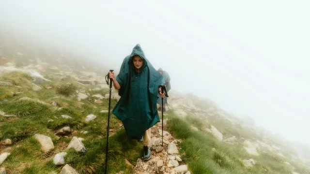
The northern coast is green for a reason: it rains in every month. June to September gives the best odds of dry days and warm sea; spring and autumn are quieter, with occasional storms. Winter closes many albergues.
Getting to the start
Irún is on the main rail line from Paris via Hendaye and is 20 minutes from San Sebastián. Bilbao and Santander airports serve pilgrims joining the route further west.
Difficulty
Demanding. Constant elevation change in the Basque Country and long stages with fewer albergues.
Places along the way
San Sebastián
Km 27, Gipuzkoa
Arriving over Monte Ulía to the curve of La Concha beach is one of the great entrances of any Camino. The old town's pintxo bars, the Monte Igueldo funicular and the film festival make it a city pilgrims linger in.
Getaria and Zarautz
Km 50–60
Zarautz has the longest beach in the Basque Country; Getaria, on its whale-shaped headland, is the birthplace of Juan Sebastián Elcano, the first man to sail around the world, and the home of txakoli wine and grilled fish.
Bilbao
Km 150, Biscay
A former steel city reinvented around the Guggenheim Museum. The route drops into the old town's seven streets and follows the Nervión to the Vizcaya hanging bridge at Portugalete, the first transporter bridge in the world.
Santillana del Mar and Altamira
Km 295, Cantabria
A medieval village of golden stone palaces so well preserved that it feels staged, and, two kilometres away, the Altamira cave with its 36,000-year-old bison, shown today through an exact replica.
Comillas
Km 315
A seaside town where the Catalan modernists built for a marquis: Gaudí's El Capricho, the Sobrellano palace and the huge Pontifical University on the hill.
The Asturian coast
Km 380–520
Cliffs, hidden coves and the bufones — blowholes that spout seawater in rough weather — around Llanes, then Ribadesella, the cider valleys of Villaviciosa and the fishing port of Cudillero, stacked in an amphitheatre above its harbour.
Villaviciosa junction
Km 455
Where the Norte splits: straight on along the coast to Gijón, or south over the hills to Oviedo and the Camino Primitivo. Many pilgrims switch here.
Ribadeo and the Praia das Catedrais
Km 580, border of Galicia
The bridge over the Ría de Ribadeo marks Galicia. A short detour west leads to the Beach of the Cathedrals, whose rock arches are walkable at low tide.
Mondoñedo
Km 615
One of the seven medieval capitals of Galicia: a cathedral with a rose window, a bishop's palace and an old town of whitewashed houses in a green valley.
Sobrado dos Monxes
Km 690
A Cistercian monastery founded in 952, with a baroque church the size of a cathedral and monks who still run the pilgrim albergue in the cloister.
Arzúa and the Camino Francés
Km 710
The Norte ends by merging with the Francés for the last 40 kilometres — a shock of company after weeks of near-empty paths.
Stages
Every pilgrim walks the Camino del Norte at a different pace, so this page does not prescribe daily stages. In the Camino.Today app you pick any two towns on the route and get the stage between them — distance, walking time, elevation profile and the weather for each hour of the walk. Plan the whole Camino stage by stage before you leave, or decide each morning how far you go today; the plan is yours to change at any time.
Where to sleep on the Camino del Norte
548 places to sleep in 176 towns along this route, 198 of them pilgrim albergues — with prices, beds, photos, contacts and the map.
Norte to Primitivo linkLeaves the Camino del Norte at Villaviciosa and climbs over the hills to Oviedo, where the Camino Primitivo begins.43.1 km
Towns along the way
Distances from Irún. Every town and village within a kilometre of the path, as shown in the app.
0 kmIrún
4.6 kmSantuario de Guadalupe
14.4 kmPasajes de San Juan
21 kmSan Sebastián
26.9 kmIgueldo
35.2 kmOrio
40.1 kmZarautz
44 kmGetaria
51.3 kmElorriaga
56.2 kmItziar
62.2 kmGalbario Ermita
78.8 kmMarkina-Xemein
82.6 kmIruzubieta
85.7 kmMonasterio de Zenarruza
92.8 kmElejalde
99.8 kmGernika
105.7 kmAlto de Morga
113.5 kmGoikolexea
120.4 kmZamudio
127.5 kmBilbao
138.2 kmBarakaldo
151.2 kmLa Arena
157 kmOntón
164.2 kmSantullán
173.8 kmAllendelagua
183.3 kmRioseco
196.1 kmTarrueza
200 kmLaredo
203.3 kmEl Puntal
211 kmHelgueras
226 kmGüemes
229 kmGalizano
236.2 kmLoredo
243 kmSantander
251.6 kmSanta Cruz de Bezana
260 kmArce
265.5 kmMogro
274.2 kmRequejada
283 kmSantillana del Mar
294.3 kmCóbreces
299.1 kmBarrio de La Iglesia
309.8 kmLa Revilla
318.5 kmSerdió
322.4 kmPesués
327.5 kmColombres
335 kmBuelna
341 kmPuertas de Vidiago
348.5 kmLlanes
352.2 kmCelorio
359.2 kmNaves
363.5 kmNueva
375.1 kmRibadesella
379.3 kmSan Pedro de Leces
389.1 kmLa Espasa
393.7 kmColunga
398.8 kmPernús
416.8 kmNiévares
421.7 kmPeón
428.6 kmDeva
447 kmSanta Eulalia
450.4 kmTabaza
455.8 kmTrasona
459.9 kmAvilés
463.8 kmSalinas
470.3 kmSantiago del Monte
474.8 kmEl Castillu
483.4 kmEl Pito
487 kmEl Rellayo
490.4 kmMumayor
496.9 kmNovellana
504.2 kmTablizo
507.6 kmCadavedo
513.2 kmQueruás
519.2 kmBarcia
524.8 kmVilluir
530.7 kmBao
547.3 kmArboces
550.8 kmValdepares
560.3 kmTol
564.2 kmBarres
568.6 kmRibadeo
573.9 kmVilela
578.3 kmA Ponte de Arante
584 kmVillamartín Pequeño
592.2 kmLourenzá
595.6 kmArroxo
600.8 kmMondoñedo
608.6 kmLousada
613.5 kmGontán
618.9 kmAs Paredes
623.4 kmMartiñán
633.8 kmVilalba
639 kmSan Xoan de Alba
645.6 kmPígara
650.9 kmBaamonde
655.8 kmSan Breixo de Parga
662.4 kmA Lagoa
674.5 kmA Roxica
688.3 kmSobrado dos Monxes
694.7 kmMadelos
702.7 kmSendelle
709.1 kmArzúa
734.1 kmSan Paio
740.6 kmSan Marcos
745.5 kmSantiago de Compostela
Common questions
How long is the Camino del Norte?
825 km from Irún to Santiago de Compostela, with about 10,186 m of climbing along the way.
How many days do you need to walk it?
Most pilgrims take 32-38 days, which works out at roughly 20 to 25 kilometres a day. You can walk it in fewer days or split it across several trips — the route is the same.
How difficult is the Camino del Norte?
Demanding. Constant elevation change in the Basque Country and long stages with fewer albergues.
Where do you sleep on the Camino del Norte?
There are 548 places to sleep along the route in 176 towns and villages, 198 of them pilgrim albergues. Each one has its prices, beds, photos and contacts on this site.
When is the best time to walk the Camino del Norte?
Late April to early June and mid-September to mid-October are the most comfortable windows: mild weather, long days and everything open. July and August are hot inland and busy; from November to March many private albergues close.
What is the Camino del Norte like?
The Basque stages are the hardest: constant climbs and descents between coves, with the reward of San Sebastián, Zarautz and Bilbao along the way. Cantabria flattens a little and adds Santillana del Mar and Comillas; Asturias brings Llanes, Ribadesella and the option to leave for the Camino Primitivo at Villaviciosa. In Galicia the route passes Ribadeo and Mondoñedo before the long, green approach to Arzúa, where it merges with the Camino Francés for the last two days into Santiago.
From the blog
Short, honest posts about walking to Santiago — gear, money, routes and the things nobody warns you about.